MyPrecincting
Software
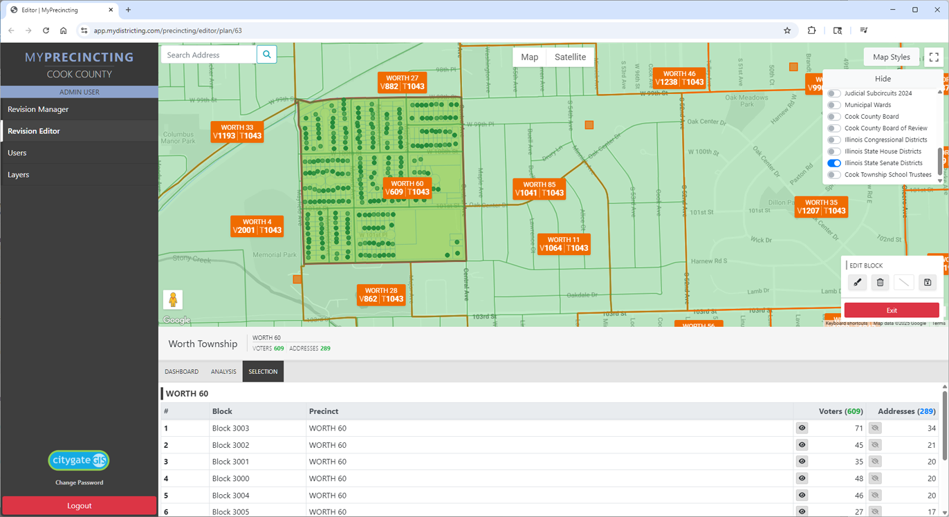
Citygate's MYPRECINCTING software can be implemented internally or used in a Software as a Service configuration. It is compatible across all PC and Mac web browsers.
The software provides the following features:
- - Ability to create and evaluate multiple scenarios before adoption
- - Map based interface with 7 Goole map options including imagery
- - Use of Google Street views inside the software
- - Ability to add other boundary layers as overlays
- - Merge, split and edit precincts
- - Analyze precincts for number of existing and potential voters
- - Ability to export street address files.
Services
Citygate provides voter geocoding and precinct alignment services designed to support elections departments with optimizing precinct boundaries and voting locations. Geocoding of voters also supports correction of miscoded precinct assignments and improvements in mail outs.
Election support services include:
- - Precinct realignment
- - Online precinct locators
- - Map generation
- - Geocoding of voters
- - Election results maps
- - Street assignment reports
Interested?